People often ask us how we handle offshore navigation : the weather, holding a course for days on end, decisions made in the middle of the night. The honest answer is that with the right system, it becomes almost easy. Here's how it's set up on Pélican.
A full Garmin suite, the heart of the system
Plotters, displays, radar, AIS, autopilot : it's all Garmin, and it all talks to each other. We've never had to juggle different brands that don't communicate well with one another, which, at sea, avoids quite a few unpleasant surprises.
The PredictWind DataHub, the bridge between the boat and the rest of the world
The PredictWind DataHub pulls in all the boat's NMEA data — wind, speed, heading, depth — and pushes it onto the boat's Ethernet network. That network is connected to a serious router, the very same one that creates the wifi on board, which is itself connected to the internet. The result : all that navigation data becomes accessible from any device on board.
A Mac mini, a good screen, and free software
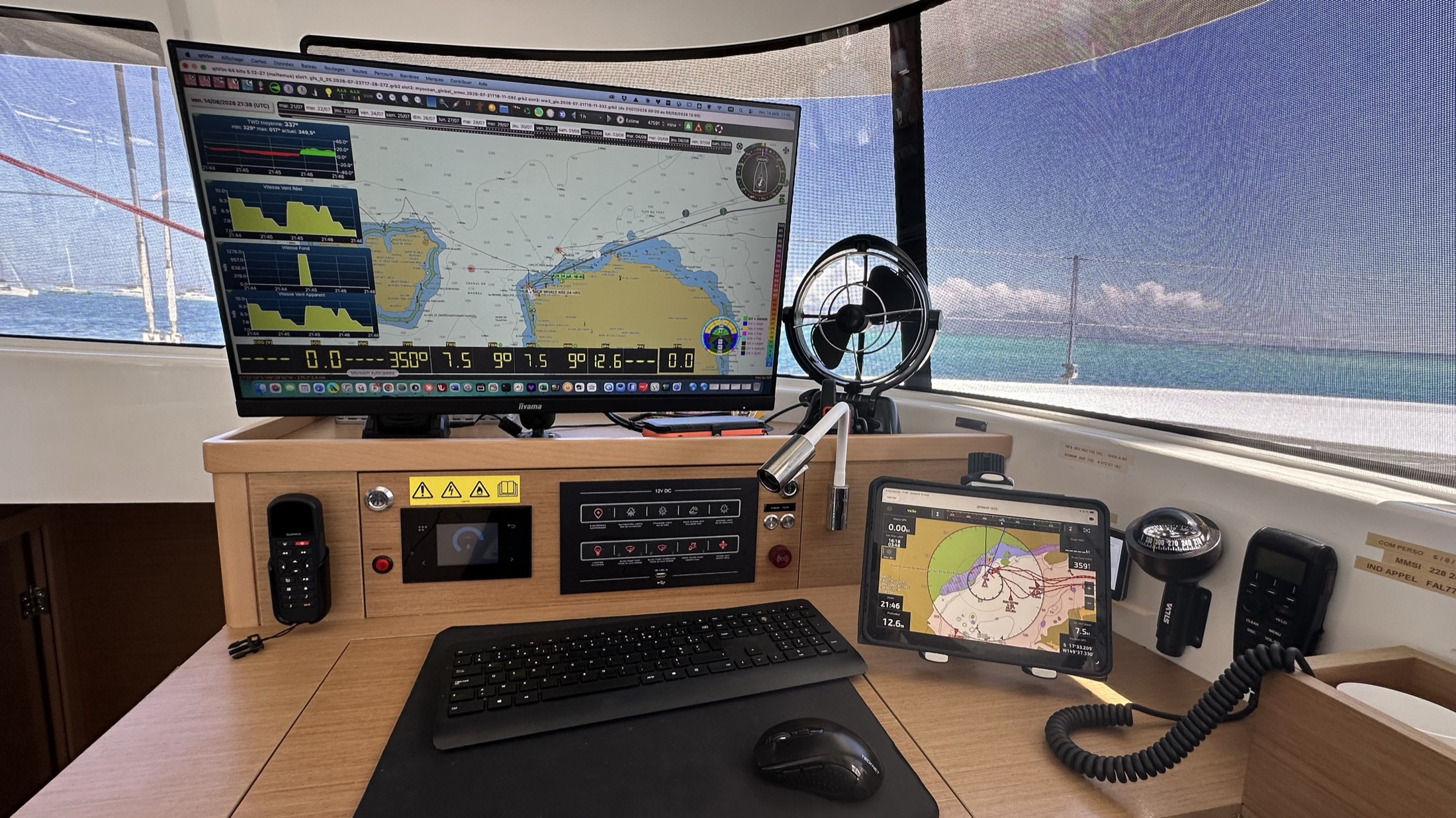
At the chart table, we run a Mac mini paired with a 27-inch screen. On it run two pieces of software that are free but remarkably capable : QtVLM for weather routing, and OpenCPN for very precise offline satellite chart display. We've also built a few custom tools of our own — for working out our polars, or for keeping an eye on the wind at anchor.
The nav station, anywhere on the boat
The most useful part is probably the screen mirroring. An iPad shows exactly what the plotters show, and we can check it from any corner of the boat — including from bed, in a cabin. It works on a phone too. In practice, that means keeping an eye on the route, the weather, or the anchorage without being stuck in front of the main screen.
And if everything fails ? A Garmin inReach beacon
For a genuine emergency — a total electrical failure, a bad surprise offshore — we carry a Garmin inReach beacon, entirely independent from the rest of the system. Enough to send a message, share a position, or trigger an alert, wherever we are.
Offshore navigation stops being something you endure. You steer it, calmly, from anywhere on the boat.